Home > An Anchorage off the Beaten-Track in Apataki

An Anchorage off the Beaten-Track in Apataki

Published : 7 September 2025

When it comes to symbols of paradise, one archipelago in French Polynesia surpasses the other four. The Tuamotu Islands are a chain of atolls, some with narrow passes and some without, and they require careful navigation. Exploring Apataki…

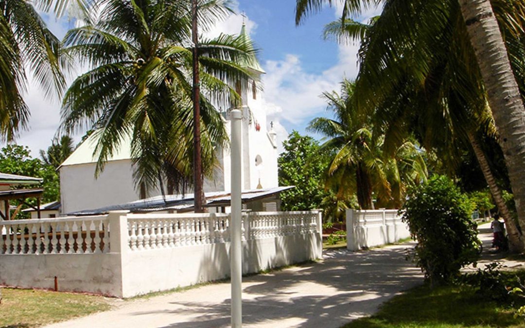
In days of old, it was known as the Dangerous Archipelago, and sailors ventured through the Tuamotu Islands without GPS devices or reliable charts. Even today, navigating this archipelago of 76 atolls requires extreme caution, with jagged reefs, unpredictable passes, and strong currents reminding you that the Pacific always has a say.

Setting off from the West Coast of the USA for your transpacific rally, you will probably arrive via the Marquesas Islands in French Polynesia. Then the Pacific Puddle Jump will take you to the Tuamotus Islands before returning to Tahiti. In short, a vast area of water in every shade of blue, and a cruise to the crystal-clear paradise of the lagoons. “At first, it is blinding. It takes hours for the eyes to adjust to this breathtaking motionless beauty. The light comes not only from the sky, but also from the waters and the shimmering sands that surround them.” This is how Albert t’Serstevens, in Tahiti et sa couronne (1950), described the Tuamotus. Beneath the surface, the water is teeming with life.

Atolls emerge when a coral reef forms around a volcano formed by a geological hot spot on Earth. The central area gradually sinks to form inland seas—lagoons—of varying size and dotted with coral heads. Atolls are surrounded by islets (motu, in Tahitian). On the ocean side, the coral reef drops sharply to depths exceeding 1,000 meters, a feature known as the drop-off. You cannot find an anchorage here. In the 18th century, Louis-Antoine de Bougainville called the Tuamotus the ‘dangerous islands’, due to exposed reefs, towering waves, and treacherous currents in the passes. Three centuries later, sailors would hardly dispute this.

Two Passes and a Careening Yard

You need to be careful in the Tuamotus, especially between the atolls, which can only be seen from less than 10 nautical miles away. There are also strong unpredictable currents in the channels between the atolls. Few of the passes are navigable. The current can reach up to ten knots in southeast gales or large swells. Tidal bores can occur at any time near the passes, both inside and outside the lagoon. It is best to navigate the main island passes, and sometimes the village channel, at slack tide while staying within the side markers. Due to coral heads and pearl farm buoys, it is best to navigate by sight in the lagoons, keeping the sun behind you or overhead, to see them clearly. As a rule, anchorages on the east are recommended. The best-known Rangiroa, Fakarava and Makatea islands have anchorages that can be very busy. Apataki should make you feel more like you are ‘alone in the world,’ even if boating is on the increase here, since there has been a careening yard here for over thirty years. Located at latitude 15°26′ S, and longitude 145°20′ W, the atoll’s roughly trapezoid-shaped lagoon spans just over 700 km2 and has two navigable passes. The 120 meter-wide (394 ft), 25 meter-deep (82 ft) Pakaka Pass to the southwest is usually easy to navigate. Outbound currents rarely exceed 5 knots and a southern counter-current can be of help during a strong ebb. The main village of Niutahi is nearby. Most of its 440 inhabitants (2022 census) live here. Here you will find a wharf served by the schooners that supply the atoll, an airport, a grocery store, the post office and an infirmary. Tehere Pass is located at the northeastern tip of Apataki. Its width and depth make it easy to cross, despite the absence of markers. Then you can choose between three possible anchorages: Rua Vahine motu, to the south, a sanctuary for seabirds and the stuff of legends (see below); Tamaro, to the southeast, sheltered from the prevailing winds, and in front of the careening yard, where you will find water, gas and petrol, a small equipment store and a book swap library. Lastly, to the northeast, Teonemahina Point is well sheltered and set in a stunning location. Apataki is not just a technical stopover for Pacific Puddle Jump sailors; it is an immersion in unspoiled Polynesia, where every gust of wind and every shimmer on the lagoon reflects the ocean’s power and fragility.

The Rua Vahine motu Legend

According to the Apataki elders, one only truly arrives on the atoll after stepping onto the pink sands of Rua Vahine motu, a 20-minute boat ride from the southern village of Niutahi. According to them, the motu is the domain of the Tarahae warrior and has welcomed legendary chiefs, navigators, and warriors. It is also the site of the atoll’s protective symbol: two sharp-edged stones.

Note

Apataki Carénage Services:

VHF 16 or 72,

tel.: 87.71.61.39, 87.71.45.29 and 87.72.78.13,

e-mail: apatakicarenageservices@gmail.com, www.apatakicarenage.com

? Any questions?