
Navigation in the Tuamotu Islands requires accuracy and caution. But it is all worthwhile when you drop anchor in blue waters that stretch as far as the eye can see, well off the beaten track. You will find Mākemo, one of the archipelago’s best kept treasures, to be utterly captivating.


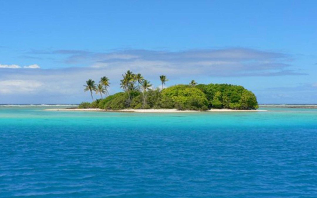
Mākemo is the third-largest atoll in French Polynesia’s Tuamotu Islands, spanning 65 kilometers (40 miles) from northwest to southeast and it is between five and eight kilometers (3-5 miles) wide. Here, the horizon is a blur of sea melting into sky, where the phrase ‘paradise lost’ feels very real.
For a long time, the Tuamotu Islands were reputed to be a ‘dangerous archipelago.’ In days of old, sailors dreaded this low chain of islands, hardly visible from the open sea and riddled with hazards: narrow passes, treacherous currents and sharp coral heads. Even today, with GPS on board, the need for caution remains. It is best to sail by sight, with the sun at your back or overhead, to spot the pearl farm buoys and avoid the coral reefs.
For a long time, the Tuamotu Islands were reputed to be a ‘dangerous archipelago.’ In days of old, sailors dreaded this low chain of islands, hardly visible from the open sea and riddled with hazards: narrow passes, treacherous currents and sharp coral heads. Even today, with GPS on board, the need for caution remains. It is best to sail by sight, with the sun at your back or overhead, to spot the pearl farm buoys and avoid the coral reefs.
Before entering Mākemo lagoon, you will need to go through either the Arikitāmiro (the main pass) or Tapuhiria passes. They are both are renowned for the wealth and diversity of their underwater fauna. You frequently come across schools of barracudas and groupers, gray sharks and humphead wrasse (Napoleon fish). For experienced divers, the passes promise exciting moments, while the more peaceful lagoon sites of Rikiriki and Pāpako, on either side of Arikitāmiro, are perfect for beginners and people who love underwater photography.
Mākemo has the unique charm of a little-visited atoll. Its coral motu (islets) are still pristine and they will draw your gaze. The atmosphere is unmistakably pa’umotu, and the locals are reserved yet welcoming, wavering between shyness and curiosity, sharing true moments of connection with sailors.
Life is centered in the peaceful village of Pouheva, near the main pass. Here you will find a spotless white church, a lively wharf bustling with supply schooners, a copra warehouse, a shady mooring site, and a lighthouse watching over the boats as they come and go. Pouheva is also the chief town of a township grouping eleven atolls. Even as an administrative center, it retains a peaceful charm.
Make sure you stop by the abandoned village of Punaruku, with its chapel, old prison, and a small cemetery on the edge of a beautiful white sandy beach, poignant reminders of a bygone era. Here, silence and sea spray tell another story of Mākemo, caught between memory and neglect.

“Perfect Atoll”
But Mākemo is not just about beautiful scenery. The atoll also has a wealth of stories and legends. If you are lucky, the Pa’umotu (Tuamotu inhabitants) will share the tales of Moeava, a famous hero of the 17th century, or the blue hole (koko) that leads to the Pō, the world of origins, populated by the mokorea—creatures that were half-human and half-fish. It was said to be located on the Vaigatika motu, near a large natural freshwater basin, that you can visit.
Foreign sailors were also captivated by it. In 1926, Alain Gerbault, the well-known French single-handed sailor, made a stopover here and dubbed it the “perfect atoll.” A description that perfectly conveys the mint-green waters, the remote, ‘end-of-the-world’ atmosphere, and lots to see and do, making it a dream destination—particularly after a Pacific Puddle Jump.
If you drop anchor at Mākemo, you get a real feel for the true spirit of the Tuamotus—a delicate balance between careful sailing and a delightful sensory immersion. Every dive in the emerald green lagoon, every legend whispered by the locals, every sunrise over a pristine motu reminds us why sailors across the globe still dream of these islands. On Mākemo, the ocean murmurs memories and the promise of perfection.

Raroia, The Kon Tiki Atoll
In 1947, Norwegian anthropologist and explorer Thor Heyerdahl and his five companions set out to prove that a people from South American had colonized Polynesia. Sailing on the balsa raft Kon-Tiki, they crossed the Pacific in 101 days, driven by trade winds, eventually running aground on Motu Tahunamaru on the atoll of Raroia, administratively attached to Mākemo. Although their theory was later disproved by botanical, linguistic and archeological research, it put the motu on the map. Even today, Raroia draws sailors eager to follow in the wake of this remarkable endeavor.
Raroia is 70 kilometers (43 miles) from Mākemo. Elliptical in shape, it is 40 kilometers (25 miles) long and 13 kilometers (8 miles) wide. You can enter the lagoon by the 80-meter-wide (50-mile-wide) Garue pass to the northwest. In strong winds, it is very rough. The Garumaoa village is near to the pass. There was another village, called Tetou, on the windward side, but it was completely destroyed by a cyclone in 1878.
Raroia is 70 kilometers (43 miles) from Mākemo. Elliptical in shape, it is 40 kilometers (25 miles) long and 13 kilometers (8 miles) wide. You can enter the lagoon by the 80-meter-wide (50-mile-wide) Garue pass to the northwest. In strong winds, it is very rough. The Garumaoa village is near to the pass. There was another village, called Tetou, on the windward side, but it was completely destroyed by a cyclone in 1878.

